
King Creek Climbs
WI2-3
ATES 2 (Challenging)
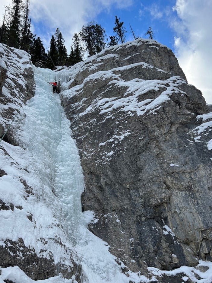
King Creek is one of the most popular ice cragging areas in the Bow Valley. It offers up to 6 different ice smears on a good season as well as some mixed lines, ranging from 20 to 40 meters long. The climbs themselves are around a 30-minute hike along the creek and have minimal avalanche hazard beyond potential sluffing on side walls and climbs on a heavy snow day.
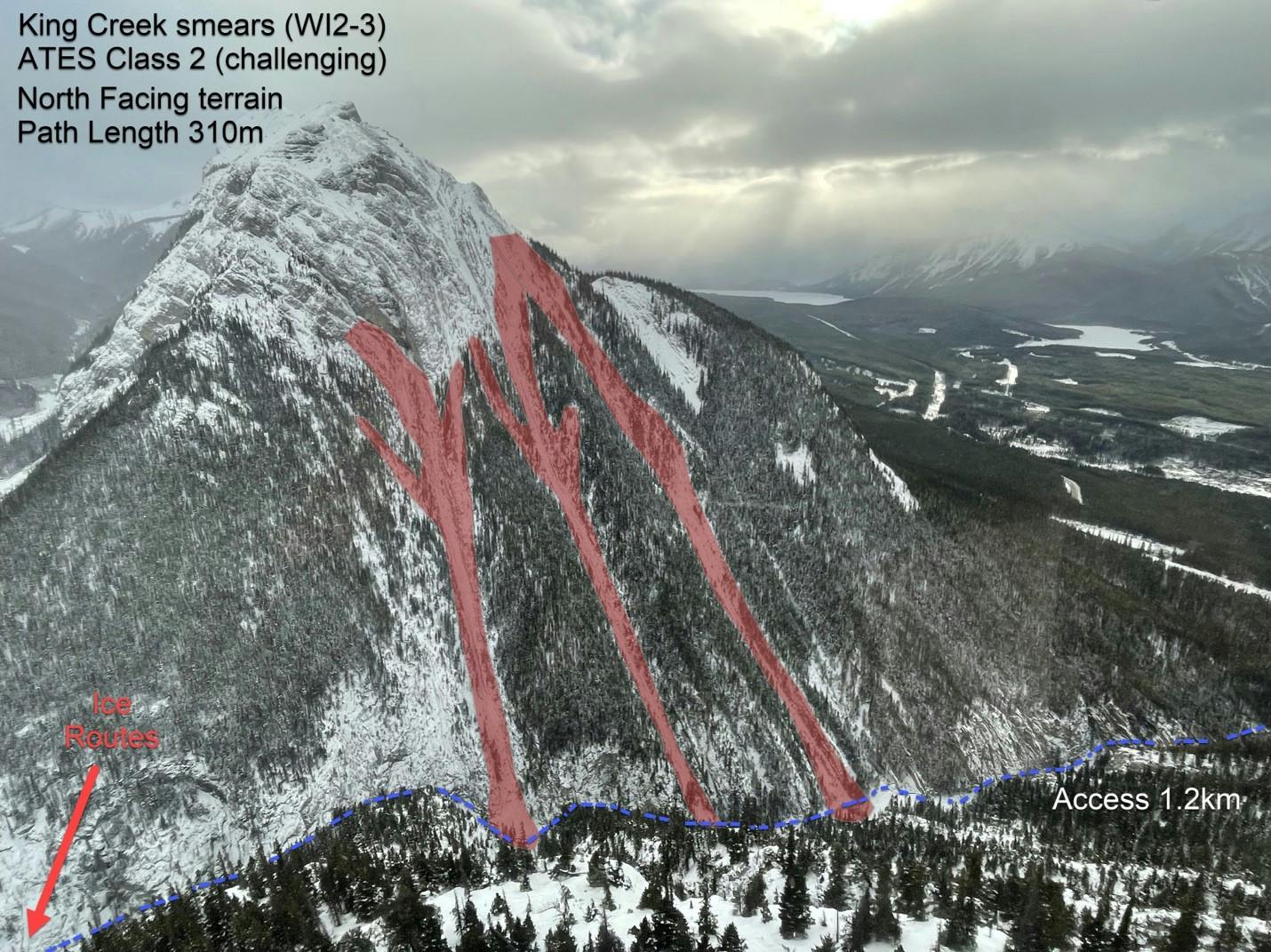
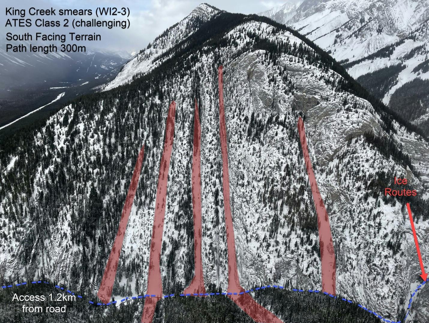
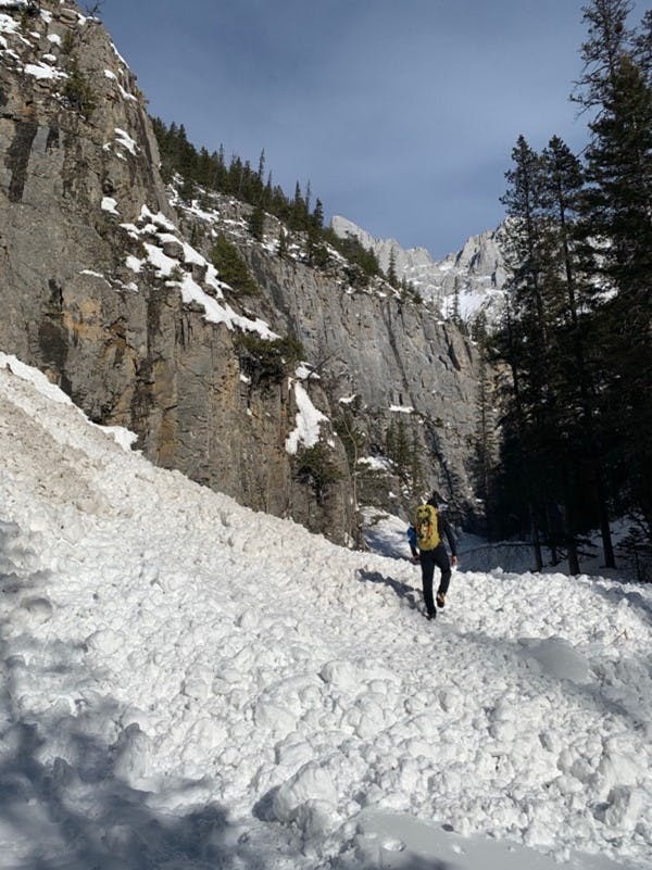
The approach does have avalanche hazard. It is a busy snowshoe and hiking trail but crosses numerous avalanche paths on both the north and south side that run the full length of the path. These paths usually run regularly throughout the winter. This risk can be managed by using good avalanche terrain travel habits and crossing one at a time.
Popularity
47 people completed the survey
- 34% climbed in King Creek 1–5 times
- 19% climbed it 6–10 times
- 47% climbed it over 10 times
Avalanche frequency
- 79% had seen debris on the approach to the climbs
- 4% had seen debris at the base of the climbs
- 4% had seen debris above the top pitch
- 10% had not seen any debris
- 9% had witnessed avalanches
Time of year and day
- Most ascents and sightings of avalanche debris were between December-April
- 50% of avalanches witnessed were reported between 6:00am-12:00pm
- 62% of avalanches witnessed were reported between 12:00-18:00pm
- No avalanches were reported after 6pm
Avalanche start zones
- 50% believe the avalanche started well above the creek
- 33% believe the avalanche started right above the creek
- 17% were unsure where the avalanche started
Avalanche Runout Distance Observed
- 63% saw debris at the base of the climb
- 11% saw debris in between the pitches of climbing
- 0% saw debris above the last pitch
Notes on Avalanche Debris
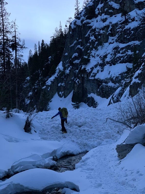
- Several people noted seeing debris at the bottom of the approach avalanche paths. This varied from small debris deposits to large 3 meter deep piles that filled the valley bottom from both sides of the canyon
- Debris has been seen early season, but it was most reported later in the year after significant warming periods
- Some people reported seeing some debris from side wall sluffing and a small pile on top of the biggest ice flow
Reported Avalanches and Incidents
- There were a few reports of seeing fresh debris over the trail when hiking out that had not been there on the hike in. Warming in the day was the factor.
- One report mentioned witnessing two loose dry size 1.5 avalanches within an hour. These were witnessed from below tree line and the start zone was unobserved. They came over the cliff approximately 50 m left of the Gully Flow. Nobody was in the vicinity and there were no involvements.
Contributing factors in order of significance
- 71% warming and solar radiation
- 71% new snow amounts
- 18% winds
- 12% known reactive layer
- 0% cornice or human/animal trigger
Summary
- Although obvious and significant avalanche paths do exist and commonly run over the popular hiking trail, there have been very few reports involvement in this area
- These paths are usually manageable by careful group management at crossing. It is good practice to go one at a time, watch each person carefully and regroup in a safe place
Additional notes from the community
There is some low degree of avalanche hazard from above the immediate slope above some of the climbs. However, there are no large start zones visible. A larger threat comes from gullies draining into the creek.
There can be vastly different conditions on each of the south facing gullies compared to the north facing gullies and it is not uncommon for the sunny gullies to melt while the shady north gullies can hold and accumulate snow.
By late season, repeated avalanches can deposit sizable accumulations in the creek bed. Exposure is limited to the time it takes to cross below them and when the risk is high, crossing one person at a time can still allow relatively safe use of the climbing in this canyon.